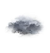
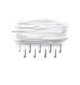
Wettervorhersage Stadt Croissy-sur-Celle

(60120)Lng : 2°10’,248 E Lat : 49°41’,808 N Höhe : 78m
Do
02
-
- -
Fr
03
-
- -
Sa
04
-
- -
So
05
-
- -
Mo
06
-
- -
Di
07
-
- -
Mi
08
-
- -
Do
09
-
- -
Fr
10
-
- -
Sa
11
-
- -
So
12
-
- -
Mo
13
-
- -
Di
14
-
- -
Mi
15
-
- -
Do
16
-
- -

NEWSLETTER

Zuverlässigkeit 80%
Donnerstag 2 juli Donnerstag 2 juli
METEO CONSULT Run : 2/07 03Z Auflösung : 1km Update vor 3h Update in 4min

Wettervorhersage

Regen (mm) (mm)
Wolken:
Wolkendecke (%.)
Niederschlag:
Niederschlagsmenge Niederschlagsmenge (mm)
Niederschlagsart Niederschlagsart
Risiken:
Niederschlagsgefahr Niederschlagsgefahr (%.)
Stürmgefahr. (%.)
Helligkeit:
Feuchtigkeit (%.)
Sichtweite (km)
UV

Temperatur

Lufttemperatur Lufttemperatur
Gefühlt temp.
Lufttemperatur
Gefühlte Temp.
Null-Grad-Isotherme (m)
Regen-/Schneegrenze Regen-/Schneegrenze (m)

Wind

Durchschnittliche Winde Durchschnittliche Winde
Böen
10m vom Boden entfernt:
Windrichtung
Windgeschwindigkeit
Böen

Gesundheit

Druck (hPa) (hPa)
Druck (hPa)
Pollen  (pollen/m3) :
Pollen (Birke)
Pollen (Olivenbaum)
Pollen (Gräser)
Pollen (Ambrosia)
Luftqualitätsindex:
Verschmutzung (ATMO)
Verschmutzung (AQI)
Verschmutzung (CAQI)
3
0
30
25
20
15
10
80
70
60
50
30
20
10
0
50
40
30
20
10
0
15
10
5
0
30
20
10
0
1030
1020
1010
  • Fr. 3
  • 10h
  • 11h
  • 12h
  • 13h
  • 14h
  • 15h
  • 16h
  • 17h
  • 18h
  • 19h
  • 20h
  • 21h
  • 22h
  • 23h
  • 00h
  • 01h
  • 02h
  • 03h
  • 04h
  • 05h
  • 06h
  • 07h
  • 08h
  • 09h
Run : 2/07 03Z Auflösung : 1km Update vor 3h Update in 4min
  • Fr. 3
  • 10h
  • 11h
  • 12h
  • 13h
  • 14h
  • 15h
  • 16h
  • 17h
  • 18h
  • 19h
  • 20h
  • 21h
  • 22h
  • 23h
  • 00h
  • 01h
  • 02h
  • 03h
  • 04h
  • 05h
  • 06h
  • 07h
  • 08h
  • 09h
  • 95
  • 95
  • 100
  • 100
  • 100
  • 100
  • 90
  • 70
  • 50
  • 30
  • 15
  • 10
  • 0
  • 5
  • 5
  • 10
  • 15
  • 25
  • 20
  • 20
  • 35
  • 45
  • 10
  • 20
  • 0
  • 0
  • 0
  • 0.2
  • 0.2
  • 0
  • 0
  • 0
  • 0
  • 0
  • 0
  • 0
  • 0
  • 0
  • 0
  • 0
  • 0
  • 0
  • 0
  • 0
  • 0
  • 0
  • 0
  • 0
  • -
  • -
  • -
  • -
  • -
  • -
  • -
  • -
  • -
  • -
  • -
  • -
  • -
  • -
  • -
  • -
  • -
  • -
  • -
  • -
  • 0
  • 45
  • 40
  • 65
  • 60
  • 0
  • 0
  • 0
  • 0
  • 0
  • 0
  • 0
  • 0
  • 0
  • 0
  • 0
  • 0
  • 0
  • 0
  • 0
  • 0
  • 0
  • 0
  • 0
  • 0
  • 0
  • 0
  • 0
  • 0
  • 0
  • 0
  • 0
  • 0
  • 0
  • 0
  • 0
  • 0
  • 0
  • 0
  • 0
  • 0
  • 0
  • 0
  • 0
  • 0
  • 0
  • 0
  • 0
  • 84
  • 83
  • 83
  • 83
  • 82
  • 78
  • 70
  • 65
  • 61
  • 60
  • 63
  • 67
  • 75
  • 83
  • 89
  • 92
  • 94
  • 95
  • 96
  • 96
  • 96
  • 96
  • 88
  • 76
  • >20
  • >20
  • >20
  • >20
  • >20
  • >20
  • >20
  • >20
  • >20
  • >20
  • >20
  • >20
  • >20
  • >20
  • 10
  • 5
  • 5
  • 4
  • 3
  • 3
  • 3
  • 3
  • 10
  • >20
  • 0
  • 0
  • 0
  • 2
  • 2
  • 2
  • 3
  • 3
  • 2
  • 1
  • 0
  • 0
  • 0
  • 0
  • 0
  • 0
  • 0
  • 0
  • 0
  • 0
  • 0
  • 0
  • 1
  • 2
  • 17 63
  • 18 64
  • 18 65
  • 19 66
  • 20 67
  • 21 69
  • 21 71
  • 22 72
  • 22 72
  • 22 72
  • 21 70
  • 20 68
  • 18 65
  • 16 62
  • 15 59
  • 14 57
  • 13 56
  • 12 54
  • 12 53
  • 11 53
  • 11 52
  • 12 53
  • 14 57
  • 17 62
  • 14 57
  • 14 58
  • 15 59
  • 16 60
  • 17 62
  • 21 69
  • 22 71
  • 24 76
  • 25 77
  • 24 75
  • 23 73
  • 21 70
  • 16 62
  • 15 59
  • 14 57
  • 13 56
  • 12 54
  • 12 53
  • 11 52
  • 11 51
  • 11 51
  • 11 52
  • 14 58
  • 18 64
  • 4150
  • 4150
  • 4150
  • 4300
  • 4300
  • 4250
  • 4300
  • 4250
  • 4200
  • 4200
  • 4100
  • 4050
  • 4000
  • 3900
  • 3900
  • 3900
  • 3900
  • 3850
  • 3850
  • 3800
  • 3800
  • 3800
  • 3800
  • 3750
  • 3850
  • 3850
  • 3850
  • 4000
  • 4000
  • 3950
  • 4000
  • 3950
  • 3900
  • 3900
  • 3800
  • 3750
  • 3700
  • 3600
  • 3600
  • 3600
  • 3600
  • 3550
  • 3550
  • 3500
  • 3500
  • 3500
  • 3500
  • 3450
  • 250° W WSW
  • 255° W WSW
  • 255° W WSW
  • 255° W WSW
  • 265° W W
  • 280° W W
  • 290° W WNW
  • 290° W WNW
  • 295° NW WNW
  • 305° NW NW
  • 310° NW NW
  • 310° NW NW
  • 310° NW NW
  • 295° NW WNW
  • 275° W W
  • 270° W W
  • 275° W W
  • 290° W WNW
  • 280° W W
  • 295° NW WNW
  • 295° NW WNW
  • 290° W WNW
  • 335° NW NNW
  • 345° N NNW
  • 10 18 5 11
  • 10 18 5 11
  • 10 18 5 11
  • 11 21 6 13
  • 10 19 5 12
  • 10 19 5 12
  • 12 22 6 14
  • 11 21 6 13
  • 11 20 6 12
  • 10 19 5 12
  • 9 17 5 11
  • 8 14 4 9
  • 5 9 3 6
  • 3 6 2 4
  • 2 4 1 2
  • 2 4 1 2
  • 2 3 1 2
  • 2 3 1 2
  • 2 3 1 2
  • 2 3 1 2
  • 2 3 1 2
  • 2 3 1 2
  • 2 4 1 2
  • 4 8 2 5
  • 18 33 9 21
  • 19 36 10 22
  • 21 38 11 24
  • 21 39 11 24
  • 22 41 11 25
  • 21 39 11 24
  • 23 42 12 26
  • 23 42 12 26
  • 22 40 11 25
  • 20 37 10 23
  • 18 34 9 21
  • 17 32 9 20
  • 13 24 7 15
  • 8 15 4 9
  • 5 10 3 6
  • 4 8 2 5
  • 4 7 2 4
  • 3 6 2 4
  • 3 6 2 4
  • 3 6 2 4
  • 3 6 2 4
  • 3 5 1 3
  • 4 7 2 4
  • 9 16 4 10
  • 1024
  • 1024
  • 1024
  • 1024
  • 1024
  • 1024
  • 1024
  • 1024
  • 1024
  • 1024
  • 1024
  • 1024
  • 1025
  • 1026
  • 1026
  • 1026
  • 1027
  • 1027
  • 1027
  • 1027
  • 1028
  • 1028
  • 1028
  • 1029
  • 0
  • 0
  • 0
  • 0
  • 0
  • 0
  • 0
  • 0
  • 0
  • 0
  • 0
  • 0
  • 0
  • 0
  • 0
  • 0
  • 0
  • 0
  • 0
  • 0
  • 0
  • 0
  • 0
  • 0
  • Daten verfügbar vom 1. Januar bis 30. Jun
  • 16
  • 17
  • 17
  • 17
  • 16
  • 16
  • 16
  • 21
  • 21
  • 19
  • 22
  • 29
  • 36
  • 32
  • 29
  • 25
  • 25
  • 23
  • 24
  • 28
  • 27
  • 15
  • 27
  • 32
  • 0
  • 0
  • 0
  • 0
  • 0
  • 0
  • 0
  • 0
  • 0
  • 0
  • 0
  • 0
  • 0
  • 0
  • 0
  • 0
  • 0
  • 0
  • 0
  • 0
  • 0
  • 0
  • 0
  • 0
  • 2
  • 1
  • 1
  • 1
  • 1
  • 1
  • 1
  • 1
  • 2
  • 2
  • 2
  • 2
  • 2
  • 1
  • 2
  • 1
  • 1
  • 1
  • 1
  • 1
  • 1
  • 1
  • 1
  • 1
  • 46
  • 42
  • 39
  • 36
  • 35
  • 38
  • 40
  • 40
  • 47
  • 50
  • 50
  • 50
  • 48
  • 45
  • 46
  • 45
  • 40
  • 39
  • 36
  • 40
  • 40
  • 42
  • 42
  • 45
  • 21
  • 19
  • 17
  • 16
  • 16
  • 17
  • 18
  • 18
  • 21
  • 23
  • 23
  • 22
  • 22
  • 20
  • 21
  • 20
  • 18
  • 17
  • 18
  • 20
  • 20
  • 21
  • 21
  • 23
Prognosen in Ortszeit erstellt
Legende   Glossar

Expertenmeinung

Today in Croissy-sur-Celle, the unsettled weather will become more unpredictable in the second half of the day.
Skies very cloudy to overcast in the morning, overcast skies clearing completely in the afternoon. Risk of some spots of rain in the morning, light rain gradually becoming less frequent in the afternoon. Moderate winds.

We are 80% sure of the situation, because it is possible that the change in the rain system may not be as clear as forecast.

Temperatures will vary between 14 and 22°C with values close to normal.
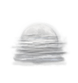
Tonight, clear spells then risk of fog towards the end of the night.
No precipitation. Moderate winds.

Beobachtungen

Station Puits-La-Vallee liegt 13 km von Croissy-sur-Celle entfernt
WIND
WETTER
Ortszeit Richt.
(°)
Geschw.
(km/h)
Böen
(km/h)
Temp.
(°C)
Niederschlag
(mm)
Bewölkung
(%)
Wetter
10h
-
-
-
16.1
0
-
-
09h
-
-
-
16.4
0
-
-
08h
-
-
-
15.8
0
-
-
Alle Stationen anzeigen
Météo France - RADOME
Wetterinformationen der Bodenstation anzeigen

Mehr erfahren

Do
02
-
- -
Fr
03
-
- -
Sa
04
-
- -
So
05
-
- -
Mo
06
-
- -
Di
07
-
- -
Mi
08
-
- -
Do
09
-
- -
Fr
10
-
- -
Sa
11
-
- -
So
12
-
- -
Mo
13
-
- -
Di
14
-
- -
Mi
15
-
- -
Do
16
-
- -
Deutsch