Freitag 15 mai
Freitag 15 mai
METEO CONSULT
Run : 15/05 00Z
Auflösung : 1km
Update vor 4h
Update in 2h
Wettervorhersage
Wolken:
Wolkendecke
(%.)
Niederschlag:
Niederschlagsmenge
Niederschlagsmenge
(mm)
Niederschlagsart
Niederschlagsart
Risiken:
Niederschlagsgefahr
Niederschlagsgefahr
(%.)
Stürmgefahr.
(%.)
Helligkeit:
Feuchtigkeit
(%.)
Sichtweite
(km)
UV
Temperatur
Lufttemperatur
Lufttemperatur
Gefühlt temp.
Lufttemperatur
Gefühlte Temp.
Null-Grad-Isotherme
(m)
Regen-/Schneegrenze
Regen-/Schneegrenze
(m)
Wind
Durchschnittliche Winde
Durchschnittliche Winde
Böen
10m vom Boden entfernt:
Windrichtung
Windgeschwindigkeit
Böen
Gesundheit
Druck
(hPa)
Pollen
(pollen/m3) :
Pollen (Birke)
Pollen (Olivenbaum)
Pollen (Gräser)
Pollen (Ambrosia)
Luftqualitätsindex:
Verschmutzung (ATMO)
Verschmutzung (AQI)
Verschmutzung (CAQI)
Expertenmeinung
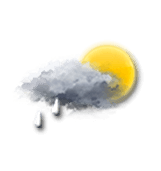
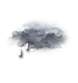
This afternoon in Les Touches, Lots of good clear periods. Possibility of showers Light winds.
We are 80% sure of the situation, because the atmosphere might be less unstable and showers rarer than forecast.
Temperatures will vary between 7 and 14°C, it will be 4°C below normal.
Tonight, clear spells, risk of mist forming.
Light showers progressively becoming less frequent. Light winds.