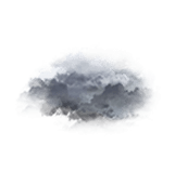
Wettervorhersage Dorf Keroger

Lng : -3°0’,588 W Lat : 48°30’,942 N Höhe : 159m
So
29
-
- -
Mo
30
-
- -
Di
31
-
- -
Mi
01
-
- -
Do
02
-
- -
Fr
03
-
- -
Sa
04
-
- -
So
05
-
- -
Mo
06
-
- -
Di
07
-
- -
Mi
08
-
- -
Do
09
-
- -
Fr
10
-
- -
Sa
11
-
- -
So
12
-
- -

NEWSLETTER

(* in Ortszeit festgelegt)
Zuverlässigkeit 90%
Sonntag 29 märz Sonntag 29 mär
METEO CONSULT Run : 29/03 00Z Auflösung : 1km Update vor 1h Update in 4h

Wettervorhersage

Regen (mm) (mm)
Wolken:
Wolkendecke (%.)
Niederschlag:
Niederschlagsmenge Niederschlagsmenge (mm)
Niederschlagsart Niederschlagsart
Risiken:
Niederschlagsgefahr Niederschlagsgefahr (%.)
Stürmgefahr. (%.)
Helligkeit:
Feuchtigkeit (%.)
Sichtweite (km)
UV

Temperatur

Lufttemperatur Lufttemperatur
Gefühlt temp.
Lufttemperatur
Gefühlte Temp.
Null-Grad-Isotherme (m)
Regen-/Schneegrenze Regen-/Schneegrenze (m)

Wind

Durchschnittliche Winde Durchschnittliche Winde
Böen
10m vom Boden entfernt:
Windrichtung
Windgeschwindigkeit
Böen

Gesundheit

Druck (hPa) (hPa)
Druck (hPa)
Pollen  (pollen/m3) :
Pollen (Birke)
Pollen (Olivenbaum)
Pollen (Gräser)
Pollen (Ambrosia)
Luftqualitätsindex:
Verschmutzung (ATMO)
Verschmutzung (AQI)
Verschmutzung (CAQI)
3
0
15
10
5
0
55
50
45
40
35
30
20
10
0
50
40
30
20
10
0
15
10
5
0
30
20
10
0
1040
1030
1020
1010
  • Mo. 30
  • 10h
  • 11h
  • 12h
  • 13h
  • 14h
  • 15h
  • 16h
  • 17h
  • 18h
  • 19h
  • 20h
  • 21h
  • 22h
  • 23h
  • 00h
  • 01h
  • 02h
  • 03h
  • 04h
  • 05h
  • 06h
  • 07h
  • 08h
  • 09h
Run : 29/03 00Z Auflösung : 1km Update vor 1h Update in 4h
  • Mo. 30
  • 10h
  • 11h
  • 12h
  • 13h
  • 14h
  • 15h
  • 16h
  • 17h
  • 18h
  • 19h
  • 20h
  • 21h
  • 22h
  • 23h
  • 00h
  • 01h
  • 02h
  • 03h
  • 04h
  • 05h
  • 06h
  • 07h
  • 08h
  • 09h
  • 0
  • 90
  • 100
  • 90
  • 95
  • 100
  • 95
  • 100
  • 100
  • 95
  • 100
  • 80
  • 100
  • 100
  • 100
  • 100
  • 100
  • 100
  • 100
  • 100
  • 95
  • 100
  • 90
  • 95
  • 0
  • 0
  • 0
  • 0
  • 0
  • 0
  • 0
  • 0
  • 0
  • 0
  • 0
  • 0
  • 0
  • 0
  • 0.2
  • 0.2
  • 0.2
  • 0
  • 0
  • 0
  • 0
  • 0
  • 0
  • 0
  • -
  • -
  • -
  • -
  • -
  • -
  • -
  • -
  • -
  • -
  • -
  • -
  • -
  • -
  • -
  • 0
  • 0
  • 0
  • 0
  • 0
  • 0
  • 0
  • 0
  • 0
  • 0
  • 0
  • 0
  • 0
  • 25
  • 70
  • 70
  • 65
  • 40
  • 35
  • 40
  • 30
  • 20
  • 0
  • 0
  • 0
  • 0
  • 0
  • 0
  • 0
  • 0
  • 0
  • 0
  • 0
  • 0
  • 0
  • 0
  • 0
  • 0
  • 0
  • 0
  • 0
  • 0
  • 0
  • 0
  • 0
  • 0
  • 0
  • 0
  • 75
  • 68
  • 69
  • 66
  • 59
  • 59
  • 61
  • 63
  • 65
  • 67
  • 72
  • 75
  • 78
  • 80
  • 86
  • 92
  • 96
  • 98
  • 98
  • 97
  • 96
  • 96
  • 95
  • 94
  • >20
  • >20
  • >20
  • >20
  • >20
  • >20
  • >20
  • >20
  • >20
  • >20
  • >20
  • >20
  • >20
  • >20
  • >20
  • >20
  • 15
  • 5
  • 5
  • 10
  • 15
  • 15
  • 15
  • >20
  • 1
  • 1
  • 1
  • 2
  • 2
  • 2
  • 2
  • 1
  • 0
  • 0
  • 0
  • 0
  • 0
  • 0
  • 0
  • 0
  • 0
  • 0
  • 0
  • 0
  • 0
  • 0
  • 0
  • 0
  • 5 40
  • 9 47
  • 9 48
  • 10 50
  • 10 51
  • 11 51
  • 11 51
  • 11 51
  • 10 50
  • 10 50
  • 9 49
  • 9 48
  • 9 47
  • 9 48
  • 9 48
  • 9 48
  • 9 49
  • 10 49
  • 10 49
  • 10 49
  • 10 49
  • 9 49
  • 9 48
  • 9 48
  • 7 44
  • 8 46
  • 8 47
  • 9 48
  • 10 51
  • 10 49
  • 9 49
  • 8 47
  • 8 46
  • 7 44
  • 6 43
  • 5 41
  • 5 40
  • 5 40
  • 5 40
  • 5 41
  • 6 42
  • 6 43
  • 6 43
  • 6 43
  • 6 42
  • 6 43
  • 6 42
  • 6 43
  • 1000
  • 1000
  • 1050
  • 1100
  • 1150
  • 1150
  • 1250
  • 1250
  • 1300
  • 1350
  • 2050
  • 2050
  • 2050
  • 2050
  • 2050
  • 2050
  • 2050
  • 2050
  • 2050
  • 2050
  • 2050
  • 2050
  • 2050
  • 2050
  • 700
  • 700
  • 750
  • 800
  • 850
  • 850
  • 950
  • 950
  • 1000
  • 1050
  • 1750
  • 1750
  • 1750
  • 1750
  • 1750
  • 1750
  • 1750
  • 1750
  • 1750
  • 1750
  • 1750
  • 1750
  • 1750
  • 1750
  • 265° W W
  • 280° W W
  • 290° W WNW
  • 290° W WNW
  • 285° W WNW
  • 285° W WNW
  • 280° W W
  • 280° W W
  • 275° W W
  • 270° W W
  • 265° W W
  • 265° W W
  • 260° W W
  • 260° W W
  • 260° W W
  • 265° W W
  • 270° W W
  • 275° W W
  • 285° W WNW
  • 295° NW WNW
  • 300° NW WNW
  • 305° NW WNW
  • 305° NW NW
  • 305° NW WNW
  • 4 8 2 5
  • 7 13 4 8
  • 6 11 3 7
  • 8 15 4 9
  • 9 16 4 10
  • 9 16 4 10
  • 10 18 5 11
  • 11 20 6 12
  • 11 20 6 12
  • 11 20 6 12
  • 10 18 5 11
  • 11 20 6 12
  • 11 21 6 13
  • 12 23 6 14
  • 12 23 6 14
  • 12 22 6 14
  • 11 20 6 12
  • 10 19 5 12
  • 10 19 5 12
  • 11 20 6 12
  • 11 21 6 13
  • 10 18 5 11
  • 10 18 5 11
  • 9 17 5 11
  • 11 20 6 12
  • 14 26 7 16
  • 13 25 7 16
  • 17 31 9 19
  • 18 34 9 21
  • 18 34 9 21
  • 19 36 10 22
  • 21 38 11 24
  • 22 40 11 25
  • 22 40 11 25
  • 22 40 11 25
  • 22 40 11 25
  • 24 44 12 27
  • 25 47 13 29
  • 25 46 13 29
  • 25 47 13 29
  • 24 44 12 27
  • 22 41 11 25
  • 22 41 11 25
  • 23 43 12 27
  • 24 45 13 28
  • 24 44 12 27
  • 21 39 11 24
  • 20 37 10 23
  • 1036
  • 1036
  • 1036
  • 1035
  • 1035
  • 1035
  • 1034
  • 1033
  • 1033
  • 1032
  • 1032
  • 1032
  • 1031
  • 1031
  • 1031
  • 1030
  • 1030
  • 1030
  • 1029
  • 1029
  • 1029
  • 1029
  • 1029
  • 1030
  • 8
  • 3
  • 18
  • 12
  • 23
  • 36
  • 68
  • 71
  • 70
  • 20
  • 15
  • 13
  • 10
  • 7
  • 0
  • 0
  • 0
  • 0
  • 0
  • 0
  • 0
  • 0
  • 0
  • 0
  • 0
  • 0
  • 0
  • 0
  • 0
  • 0
  • 0
  • 0
  • 0
  • 0
  • 0
  • 0
  • 0
  • 0
  • 0
  • 0
  • 0
  • 0
  • 0
  • 0
  • 0
  • 0
  • 0
  • 0
  • 0
  • 0
  • 0
  • 0
  • 0
  • 0
  • 0
  • 0
  • 0
  • 0
  • 0
  • 0
  • 0
  • 0
  • 0
  • 0
  • 0
  • 0
  • 0
  • 0
  • 0
  • 0
  • 0
  • 0
  • Daten verfügbar vom 1. Juni bis 31. Oktober
  • 2
  • 2
  • 2
  • 2
  • 2
  • 2
  • 2
  • 2
  • 2
  • 2
  • 2
  • 2
  • 2
  • 2
  • 2
  • 2
  • 2
  • 2
  • 2
  • 2
  • 2
  • 2
  • 2
  • 2
  • 70
  • 74
  • 81
  • 86
  • 87
  • 89
  • 90
  • 88
  • 87
  • 88
  • 85
  • 83
  • 82
  • 86
  • 84
  • 82
  • 80
  • 78
  • 74
  • 75
  • 73
  • 71
  • 71
  • 72
  • 32
  • 34
  • 37
  • 39
  • 40
  • 40
  • 41
  • 40
  • 40
  • 40
  • 39
  • 38
  • 37
  • 39
  • 38
  • 37
  • 36
  • 35
  • 34
  • 34
  • 33
  • 32
  • 32
  • 33
Prognosen in Ortszeit erstellt
Letztes Update vor 2min | Nächstes Update in 3h
Legende

Expertenmeinung

Today in Keroger, the situation will deteriorate sharply.
Predominantly sunny in the morning, very cloudy skies to overcast in the afternoon. No precipitation. Moderate winds.

The reliability of the situation is assessed at 90%.

Temperatures will vary between 2 and 11°C, it will be cold in the morning.

Tonight, overcast skies.
Drizzle in the early hours. Moderate winds.

Beobachtungen

Station St Brieuc liegt 12 km von Keroger entfernt
WIND
WETTER
Ortszeit Richt.
(°)
Geschw.
(km/h)
Böen
(km/h)
Temp.
(°C)
Niederschlag
(mm)
Bewölkung
(%)
Wetter
08h
240
10
14
4.1
0
-
-
07h
270
10
17
3
0
-
-
06h
260
13
18
2.7
0
-
-
Alle Stationen anzeigen
Météo France - RADOME
Wetterinformationen der Bodenstation anzeigen

Mehr erfahren

So
29
-
- -
Mo
30
-
- -
Di
31
-
- -
Mi
01
-
- -
Do
02
-
- -
Fr
03
-
- -
Sa
04
-
- -
So
05
-
- -
Mo
06
-
- -
Di
07
-
- -
Mi
08
-
- -
Do
09
-
- -
Fr
10
-
- -
Sa
11
-
- -
So
12
-
- -
Deutsch