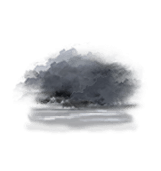
Wettervorhersage Dorf Wald Vierter Teil

Lng : 7°33’,72 E Lat : 48°42’,174 N Höhe : 198m
Fr
15
-
- -
Sa
16
-
- -
So
17
-
- -
Mo
18
-
- -
Di
19
-
- -
Mi
20
-
- -
Do
21
-
- -
Fr
22
-
- -
Sa
23
-
- -
So
24
-
- -
Mo
25
-
- -
Di
26
-
- -
Mi
27
-
- -
Do
28
-
- -
Fr
29
-
- -

NEWSLETTER

Zuverlässigkeit 80%
Freitag 15 mai Freitag 15 mai
METEO CONSULT Run : 14/05 00Z Auflösung : 1km Update vor 10h Update unmittelbar bevorstehend

Wettervorhersage

Regen (mm) (mm)
Wolken:
Wolkendecke (%.)
Niederschlag:
Niederschlagsmenge Niederschlagsmenge (mm)
Niederschlagsart Niederschlagsart
Risiken:
Niederschlagsgefahr Niederschlagsgefahr (%.)
Stürmgefahr. (%.)
Helligkeit:
Feuchtigkeit (%.)
Sichtweite (km)
UV

Temperatur

Lufttemperatur Lufttemperatur
Gefühlt temp.
Lufttemperatur
Gefühlte Temp.
Null-Grad-Isotherme (m)
Regen-/Schneegrenze Regen-/Schneegrenze (m)

Wind

Durchschnittliche Winde Durchschnittliche Winde
Böen
10m vom Boden entfernt:
Windrichtung
Windgeschwindigkeit
Böen

Gesundheit

Druck (hPa) (hPa)
Druck (hPa)
Pollen  (pollen/m3) :
Pollen (Birke)
Pollen (Olivenbaum)
Pollen (Gräser)
Pollen (Ambrosia)
Luftqualitätsindex:
Verschmutzung (ATMO)
Verschmutzung (AQI)
Verschmutzung (CAQI)
3
0
15
10
5
0
60
50
40
30
20
15
10
5
0
40
30
20
10
0
15
10
5
0
30
20
10
0
1020
1010
1000
990
  • Sa. 16
  • 03h
  • 04h
  • 05h
  • 06h
  • 07h
  • 08h
  • 09h
  • 10h
  • 11h
  • 12h
  • 13h
  • 14h
  • 15h
  • 16h
  • 17h
  • 18h
  • 19h
  • 20h
  • 21h
  • 22h
  • 23h
  • 00h
  • 01h
  • 02h
Run : 14/05 00Z Auflösung : 1km Update vor 10h Update unmittelbar bevorstehend
  • Sa. 16
  • 03h
  • 04h
  • 05h
  • 06h
  • 07h
  • 08h
  • 09h
  • 10h
  • 11h
  • 12h
  • 13h
  • 14h
  • 15h
  • 16h
  • 17h
  • 18h
  • 19h
  • 20h
  • 21h
  • 22h
  • 23h
  • 00h
  • 01h
  • 02h
  • 100
  • 100
  • 100
  • 100
  • 100
  • 95
  • 95
  • 95
  • 80
  • 75
  • 75
  • 80
  • 60
  • 70
  • 50
  • 75
  • 45
  • 25
  • 35
  • 60
  • 55
  • 25
  • 25
  • 45
  • 0.2
  • 0.5
  • 0.1
  • 0
  • 0
  • 0
  • 0
  • 0
  • 0
  • 0
  • 0
  • 0
  • 0
  • 0
  • 0
  • 0
  • 0
  • 0
  • 0
  • 0
  • 0
  • 0
  • 0
  • 0
  • -
  • -
  • -
  • -
  • -
  • -
  • -
  • 100
  • 100
  • 100
  • 30
  • 20
  • 20
  • 25
  • 0
  • 0
  • 20
  • 30
  • 35
  • 35
  • 35
  • 45
  • 45
  • 35
  • 20
  • 0
  • 0
  • 20
  • 0
  • 0
  • 0
  • 0
  • 0
  • 0
  • 0
  • 0
  • 0
  • 0
  • 0
  • 0
  • 0
  • 0
  • 0
  • 0
  • 0
  • 0
  • 0
  • 0
  • 0
  • 0
  • 0
  • 0
  • 0
  • 0
  • 0
  • 90
  • 91
  • 92
  • 94
  • 93
  • 91
  • 86
  • 81
  • 75
  • 69
  • 64
  • 65
  • 65
  • 64
  • 63
  • 66
  • 67
  • 71
  • 79
  • 84
  • 83
  • 87
  • 88
  • 89
  • 5
  • 5
  • 5
  • 5
  • 5
  • 5
  • 15
  • >20
  • >20
  • >20
  • >20
  • >20
  • >20
  • >20
  • >20
  • >20
  • >20
  • >20
  • >20
  • >20
  • >20
  • 15
  • 10
  • 10
  • 0
  • 0
  • 0
  • 0
  • 0
  • 0
  • 1
  • 1
  • 2
  • 3
  • 3
  • 3
  • 3
  • 2
  • 2
  • 1
  • 0
  • 0
  • 0
  • 0
  • 0
  • 0
  • 0
  • 0
  • 7 44
  • 7 44
  • 7 44
  • 6 42
  • 6 43
  • 7 45
  • 8 47
  • 9 48
  • 10 50
  • 11 51
  • 11 53
  • 11 53
  • 12 53
  • 12 54
  • 12 54
  • 11 53
  • 11 52
  • 11 51
  • 9 48
  • 8 46
  • 8 46
  • 7 44
  • 6 43
  • 6 42
  • 6 44
  • 6 43
  • 6 43
  • 5 41
  • 6 43
  • 7 44
  • 8 47
  • 10 49
  • 11 52
  • 13 55
  • 14 56
  • 13 56
  • 12 53
  • 14 57
  • 14 57
  • 12 53
  • 12 53
  • 11 52
  • 9 48
  • 7 45
  • 6 43
  • 5 41
  • 4 39
  • 4 38
  • 1300
  • 1300
  • 1250
  • 1200
  • 1200
  • 1200
  • 1200
  • 1250
  • 1250
  • 1300
  • 1350
  • 1450
  • 1450
  • 1500
  • 1550
  • 1550
  • 1600
  • 1600
  • 1550
  • 1550
  • 1500
  • 1500
  • 1450
  • 1400
  • 1000
  • 1000
  • 950
  • 900
  • 900
  • 900
  • 900
  • 950
  • 950
  • 1000
  • 1050
  • 1150
  • 1150
  • 1200
  • 1250
  • 1250
  • 1300
  • 1300
  • 1250
  • 1250
  • 1200
  • 1200
  • 1150
  • 1100
  • 175° S S
  • 195° S SSW
  • 215° SW SW
  • 250° W WSW
  • 250° W WSW
  • 285° W WNW
  • 295° NW WNW
  • 300° NW WNW
  • 305° NW NW
  • 305° NW NW
  • 315° NW NW
  • 325° NW NNW
  • 335° NW NNW
  • 325° NW NW
  • 315° NW NW
  • 320° NW NW
  • 325° NW NNW
  • 315° NW NW
  • 260° W W
  • 240° SW WSW
  • 255° W WSW
  • 270° W W
  • 275° W W
  • 280° W WNW
  • 1 1 0 1
  • 1 1 0 1
  • 1 2 1 1
  • 2 3 1 2
  • 2 3 1 2
  • 3 5 1 3
  • 4 8 2 5
  • 5 9 3 6
  • 5 9 3 6
  • 6 11 3 7
  • 6 11 3 7
  • 7 13 4 8
  • 9 16 4 10
  • 8 14 4 9
  • 8 14 4 9
  • 8 15 4 9
  • 5 9 3 6
  • 3 5 1 3
  • 1 2 1 1
  • 2 4 1 2
  • 4 7 2 4
  • 5 9 3 6
  • 5 10 3 6
  • 6 11 3 7
  • 3 5 1 3
  • 4 7 2 4
  • 4 8 2 5
  • 3 6 2 4
  • 5 10 3 6
  • 6 12 3 7
  • 9 17 5 11
  • 10 19 5 12
  • 11 21 6 13
  • 12 23 6 14
  • 15 28 8 17
  • 16 30 8 19
  • 18 33 9 21
  • 17 31 9 19
  • 18 33 9 21
  • 19 36 10 22
  • 17 31 9 19
  • 10 19 5 12
  • 9 16 4 10
  • 8 15 4 9
  • 10 18 5 11
  • 10 18 5 11
  • 11 21 6 13
  • 12 22 6 14
  • 1000
  • 1001
  • 1001
  • 1001
  • 1002
  • 1002
  • 1002
  • 1002
  • 1003
  • 1003
  • 1003
  • 1003
  • 1003
  • 1003
  • 1003
  • 1004
  • 1004
  • 1005
  • 1005
  • 1006
  • 1006
  • 1007
  • 1007
  • 1007
  • 0
  • 0
  • 0
  • 0
  • 0
  • 0
  • 0
  • 0
  • 0
  • 0
  • 0
  • 0
  • 0
  • 0
  • 0
  • 0
  • 0
  • 0
  • 0
  • 0
  • 0
  • 0
  • 0
  • 0
  • 0
  • 0
  • 0
  • 0
  • 0
  • 0
  • 0
  • 0
  • 0
  • 0
  • 0
  • 0
  • 0
  • 0
  • 0
  • 0
  • 0
  • 0
  • 0
  • 0
  • 0
  • 0
  • 0
  • 0
  • 0
  • 0
  • 0
  • 0
  • 0
  • 0
  • 0
  • 0
  • 6
  • 10
  • 10
  • 10
  • 9
  • 8
  • 7
  • 9
  • 10
  • 13
  • 18
  • 20
  • 15
  • 11
  • 7
  • 3
  • Daten verfügbar vom 1. Juni bis 31. Oktober
  • 1
  • 1
  • 1
  • 1
  • 1
  • 1
  • 1
  • 2
  • 2
  • 2
  • 2
  • 2
  • 2
  • 2
  • 2
  • 2
  • 2
  • 2
  • 2
  • 2
  • 2
  • 2
  • 2
  • 2
  • 37
  • 35
  • 32
  • 30
  • 33
  • 36
  • 42
  • 48
  • 55
  • 59
  • 63
  • 68
  • 72
  • 77
  • 80
  • 81
  • 79
  • 79
  • 66
  • 62
  • 57
  • 53
  • 48
  • 46
  • 17
  • 16
  • 15
  • 13
  • 15
  • 16
  • 19
  • 22
  • 25
  • 27
  • 29
  • 31
  • 33
  • 35
  • 36
  • 37
  • 36
  • 36
  • 30
  • 28
  • 26
  • 24
  • 22
  • 21
Prognosen in Ortszeit erstellt
Legende   Glossar

Expertenmeinung

Today in Wald Vierter Teil, the sky will remain very cloudy.
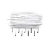
Skies very cloudy to overcast in the morning, good clear periods with lots of cloud in the afternoon. Risk of some spots of rain in the morning, possibility of showers in the afternoon. Light winds.

We are 80% sure of the situation, because the atmosphere might be less unstable and showers more frequent than forecast.

Temperatures will vary between 6 and 12°C, it will be 6°C below normal.

Tonight, cloudy spells, sometimes dense.
Possibility of showers Light winds.

Beobachtungen

Station Waltenheim-Sur-Zorn liegt 6 km von Wald Vierter Teil entfernt
WIND
WETTER
Ortszeit Richt.
(°)
Geschw.
(km/h)
Böen
(km/h)
Temp.
(°C)
Niederschlag
(mm)
Bewölkung
(%)
Wetter
03h
270
4
8
6.7
0.2
-
-
01h
220
6
13
6.8
0.2
-
-
23h
280
7
26
7.5
0
-
-
Alle Stationen anzeigen
Météo France - RADOME
Wetterinformationen der Bodenstation anzeigen

Mehr erfahren

Fr
15
-
- -
Sa
16
-
- -
So
17
-
- -
Mo
18
-
- -
Di
19
-
- -
Mi
20
-
- -
Do
21
-
- -
Fr
22
-
- -
Sa
23
-
- -
So
24
-
- -
Mo
25
-
- -
Di
26
-
- -
Mi
27
-
- -
Do
28
-
- -
Fr
29
-
- -
Deutsch