Wettervorhersage Dorf Stein

Lng : 7°18’,72 E Lat : 48°59’,85 N Höhe : 312m
Sa
28
-
- -
So
29
-
- -
Mo
30
-
- -
Di
31
-
- -
Mi
01
-
- -
Do
02
-
- -
Fr
03
-
- -
Sa
04
-
- -
So
05
-
- -
Mo
06
-
- -
Di
07
-
- -
Mi
08
-
- -
Do
09
-
- -
Fr
10
-
- -
Sa
11
-
- -

NEWSLETTER

(* in Ortszeit festgelegt)
Zuverlässigkeit 80%
Samstag 28 märz Samstag 28 mär
METEO CONSULT Run : 27/03 00Z Auflösung : 1km Update vor 3h Update in 4h

Wettervorhersage

Regen (mm) (mm)
Wolken:
Wolkendecke (%.)
Niederschlag:
Niederschlagsmenge Niederschlagsmenge (mm)
Niederschlagsart Niederschlagsart
Risiken:
Niederschlagsgefahr Niederschlagsgefahr (%.)
Stürmgefahr. (%.)
Helligkeit:
Feuchtigkeit (%.)
Sichtweite (km)
UV

Temperatur

Lufttemperatur Lufttemperatur
Gefühlt temp.
Lufttemperatur
Gefühlte Temp.
Null-Grad-Isotherme (m)
Regen-/Schneegrenze Regen-/Schneegrenze (m)

Wind

Durchschnittliche Winde Durchschnittliche Winde
Böen
10m vom Boden entfernt:
Windrichtung
Windgeschwindigkeit
Böen

Gesundheit

Druck (hPa) (hPa)
Druck (hPa)
Pollen  (pollen/m3) :
Pollen (Birke)
Pollen (Olivenbaum)
Pollen (Gräser)
Pollen (Ambrosia)
Luftqualitätsindex:
Verschmutzung (ATMO)
Verschmutzung (AQI)
Verschmutzung (CAQI)
3
0
5
0
-5
40
35
30
25
20
15
10
5
0
30
20
10
0
10
5
0
20
15
10
5
0
1030
1020
1010
  • So. 29
  • 07h
  • 08h
  • 09h
  • 10h
  • 11h
  • 12h
  • 13h
  • 14h
  • 15h
  • 16h
  • 17h
  • 18h
  • 19h
  • 20h
  • 21h
  • 22h
  • 23h
  • 00h
  • 01h
  • 03h
  • 04h
  • 05h
  • 06h
  • 07h
Run : 27/03 00Z Auflösung : 1km Update vor 3h Update in 4h
  • So. 29
  • 07h
  • 08h
  • 09h
  • 10h
  • 11h
  • 12h
  • 13h
  • 14h
  • 15h
  • 16h
  • 17h
  • 18h
  • 19h
  • 20h
  • 21h
  • 22h
  • 23h
  • 00h
  • 01h
  • 03h
  • 04h
  • 05h
  • 06h
  • 07h
  • 100
  • 100
  • 100
  • 100
  • 100
  • 100
  • 100
  • 100
  • 100
  • 100
  • 100
  • 100
  • 100
  • 100
  • 100
  • 85
  • 70
  • 55
  • 45
  • 25
  • 25
  • 20
  • 10
  • 20
  • 0
  • 0
  • 0
  • 0.1
  • 0.4
  • 0.6
  • 0.7
  • 0.8
  • 0.6
  • 0.2
  • 0.2
  • 0.2
  • 0.1
  • 0
  • 0
  • 0
  • 0
  • 0
  • 0
  • 0
  • 0
  • 0
  • 0
  • 0
  • -
  • -
  • -
  • -
  • -
  • -
  • -
  • -
  • -
  • -
  • -
  • -
  • 0
  • 0
  • 30
  • 55
  • 70
  • 80
  • 80
  • 80
  • 70
  • 60
  • 60
  • 60
  • 50
  • 30
  • 0
  • 0
  • 0
  • 0
  • 0
  • 0
  • 0
  • 0
  • 0
  • 0
  • 0
  • 0
  • 0
  • 0
  • 0
  • 0
  • 0
  • 0
  • 0
  • 0
  • 0
  • 0
  • 0
  • 0
  • 0
  • 0
  • 0
  • 0
  • 0
  • 0
  • 0
  • 0
  • 0
  • 0
  • 62
  • 53
  • 59
  • 68
  • 79
  • 86
  • 91
  • 95
  • 96
  • 96
  • 94
  • 96
  • 95
  • 93
  • 93
  • 89
  • 89
  • 88
  • 88
  • 89
  • 90
  • 90
  • 91
  • 95
  • >20
  • >20
  • >20
  • >20
  • >20
  • 15
  • 5
  • 4
  • 3
  • 3
  • 5
  • 3
  • 3
  • 5
  • 5
  • 10
  • 10
  • 10
  • 10
  • 10
  • 10
  • 10
  • 5
  • 4
  • 0
  • 0
  • 0
  • 0
  • 1
  • 1
  • 1
  • 0
  • 0
  • 0
  • 0
  • 0
  • 0
  • 0
  • 0
  • 0
  • 0
  • 0
  • 0
  • 0
  • 0
  • 0
  • 0
  • 0
  • 0 33
  • 2 36
  • 2 36
  • 2 36
  • 3 37
  • 3 37
  • 2 36
  • 2 36
  • 2 36
  • 3 37
  • 4 38
  • 4 39
  • 3 38
  • 3 37
  • 2 36
  • 2 36
  • 1 34
  • 1 33
  • 0 32
  • 0 31
  • -1 31
  • -1 30
  • -1 29
  • -2 29
  • -1 31
  • 1 33
  • 1 34
  • 1 34
  • 1 34
  • 1 34
  • 1 34
  • 1 33
  • 1 33
  • 1 35
  • 3 37
  • 3 37
  • 2 36
  • 1 35
  • 1 33
  • 0 32
  • 0 31
  • -1 30
  • -1 29
  • -2 29
  • -2 29
  • -2 28
  • -2 28
  • -3 27
  • 850
  • 850
  • 750
  • 600
  • 600
  • 600
  • 600
  • 600
  • 700
  • 900
  • 950
  • 950
  • 950
  • 950
  • 950
  • 950
  • 900
  • 850
  • 800
  • 750
  • 750
  • 700
  • 700
  • 700
  • 550
  • 550
  • 450
  • 300
  • 300
  • 300
  • 300
  • 300
  • 400
  • 600
  • 650
  • 650
  • 650
  • 650
  • 650
  • 650
  • 600
  • 550
  • 500
  • 450
  • 450
  • 400
  • 400
  • 400
  • 205° SW SSW
  • 220° SW SW
  • 220° SW SW
  • 220° SW SW
  • 220° SW SW
  • 230° SW SW
  • 240° SW WSW
  • 250° W WSW
  • 250° W WSW
  • 260° W W
  • 280° W W
  • 280° W W
  • 315° NW NW
  • 325° NW NW
  • 320° NW NW
  • 325° NW NW
  • 320° NW NW
  • 320° NW NW
  • 330° NW NNW
  • 320° NW NW
  • 325° NW NW
  • 320° NW NW
  • 320° NW NW
  • 315° NW NW
  • 4 7 2 4
  • 5 9 3 6
  • 5 10 3 6
  • 5 10 3 6
  • 5 10 3 6
  • 6 11 3 7
  • 6 12 3 7
  • 6 11 3 7
  • 5 10 3 6
  • 5 9 3 6
  • 5 9 3 6
  • 4 8 2 5
  • 3 6 2 4
  • 4 7 2 4
  • 4 8 2 5
  • 5 9 3 6
  • 4 8 2 5
  • 4 8 2 5
  • 4 7 2 4
  • 3 6 2 4
  • 3 6 2 4
  • 3 6 2 4
  • 3 5 1 3
  • 3 5 1 3
  • 9 17 5 11
  • 11 21 6 13
  • 12 23 6 14
  • 13 24 7 15
  • 13 24 7 15
  • 13 25 7 16
  • 15 27 8 17
  • 15 27 8 17
  • 13 24 7 15
  • 12 23 6 14
  • 11 21 6 13
  • 10 19 5 12
  • 12 23 6 14
  • 12 22 6 14
  • 14 26 7 16
  • 13 24 7 15
  • 12 23 6 14
  • 12 22 6 14
  • 9 17 5 11
  • 8 15 4 9
  • 7 13 4 8
  • 6 12 3 7
  • 6 11 3 7
  • 5 10 3 6
  • 1022
  • 1022
  • 1022
  • 1021
  • 1021
  • 1021
  • 1021
  • 1021
  • 1021
  • 1021
  • 1021
  • 1022
  • 1023
  • 1023
  • 1024
  • 1025
  • 1025
  • 1026
  • 1026
  • 1027
  • 1027
  • 1027
  • 1028
  • 1028
  • 1
  • 2
  • 2
  • 1
  • 0
  • 0
  • 0
  • 0
  • 0
  • 0
  • 0
  • 0
  • 0
  • 0
  • 1
  • 5
  • 11
  • 14
  • 12
  • 10
  • 9
  • 8
  • 5
  • 4
  • 0
  • 0
  • 0
  • 0
  • 0
  • 0
  • 0
  • 0
  • 0
  • 0
  • 0
  • 0
  • 0
  • 0
  • 0
  • 0
  • 0
  • 0
  • 0
  • 0
  • 0
  • 0
  • 0
  • 0
  • 0
  • 0
  • 0
  • 0
  • 0
  • 0
  • 0
  • 0
  • 0
  • 0
  • 0
  • 0
  • 0
  • 0
  • 0
  • 0
  • 0
  • 0
  • 0
  • 0
  • 0
  • 0
  • 0
  • 0
  • Daten verfügbar vom 1. Juni bis 31. Oktober
  • 2
  • 2
  • 2
  • 2
  • 2
  • 2
  • 2
  • 2
  • 2
  • 2
  • 2
  • 2
  • 2
  • 2
  • 2
  • 2
  • 2
  • 2
  • 2
  • 2
  • 2
  • 2
  • 2
  • 2
  • 66
  • 70
  • 79
  • 80
  • 80
  • 83
  • 82
  • 79
  • 74
  • 69
  • 62
  • 59
  • 57
  • 55
  • 60
  • 61
  • 60
  • 57
  • 55
  • 55
  • 54
  • 54
  • 54
  • 52
  • 30
  • 32
  • 36
  • 36
  • 37
  • 38
  • 37
  • 36
  • 34
  • 31
  • 28
  • 27
  • 26
  • 25
  • 27
  • 28
  • 27
  • 26
  • 25
  • 25
  • 25
  • 25
  • 25
  • 24
Prognosen in Ortszeit erstellt
Letztes Update vor 9min | Nächstes Update in 3h
Legende

Expertenmeinung

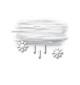
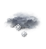
Today in Stein, rain and snow will affect the region.
Skies very cloudy, becoming totally overcast during the morning, overcast skies and reduced visibility in the afternoon. Light sleet. Light winds.

We are 80% sure of the situation, because there is a doubt about the altitude of the rain-snow line.

Temperatures will vary between -1 and 4°C, it will be cold in the morning and 5°C below normal.

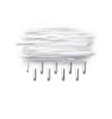
Tonight, clear periods developing.
Drizzle fading over time. Light winds.

Beobachtungen

Station Mouterhouse liegt 11 km von Stein entfernt
WIND
WETTER
Ortszeit Richt.
(°)
Geschw.
(km/h)
Böen
(km/h)
Temp.
(°C)
Niederschlag
(mm)
Bewölkung
(%)
Wetter
06h
-
-
-
-2.7
-
-
-
05h
-
-
-
-3.2
0
-
-
04h
-
-
-
-4.4
0
-
-
Alle Stationen anzeigen
Météo France - RADOME
Wetterinformationen der Bodenstation anzeigen

Mehr erfahren

Sa
28
-
- -
So
29
-
- -
Mo
30
-
- -
Di
31
-
- -
Mi
01
-
- -
Do
02
-
- -
Fr
03
-
- -
Sa
04
-
- -
So
05
-
- -
Mo
06
-
- -
Di
07
-
- -
Mi
08
-
- -
Do
09
-
- -
Fr
10
-
- -
Sa
11
-
- -
Deutsch