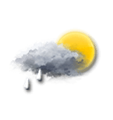
Wettervorhersage Stadt Nesselstauden

AUTLängengrad : 15°28’,2 E Breitengrad : 48°19’,86 N Höhe : 510m
Mi
22
-
- -
Do
23
-
- -
Fr
24
-
- -
Sa
25
-
- -
So
26
-
- -
Mo
27
-
- -
Di
28
-
- -
Mi
29
-
- -
Do
30
-
- -
Fr
31
-
- -
Sa
01
-
- -
So
02
-
- -
Mo
03
-
- -
Di
04
-
- -
Mi
05
-
- -

NEWSLETTER

(in Ortszeit festgelegt)
Zuverlässigkeit 90%
Mittwoch 22 oktober

Wettervorhersage

Regen (mm) (mm)
Wolkendecke(%.)
Niederschlagsmenge(mm)
Niederschlagsart
Niederschlagsgefahr(%.)
Feuchtigkeit(%.)
Sichtweite(km)
UV

Temperatur

Lufttemperatur
Gefühlt temp.
Lufttemperatur
Gefühlte Temp.
Null-Grad-Isotherme (m)
Regen-/Schneegrenze (m)

Wind

Durchschnittliche Winde
Böen
10m vom Boden entfernt:
Windrichtung
Windgeschwindigkeit
Böen

Gesundheit

Druck (hPa) (hPa)
Druck (hPa)
Pollen (Birke) (pollen/m3)
Pollen (Olivenbaum) (pollen/m3)
Pollen (Gräser) (pollen/m3)
Pollen (Ambrosia) (pollen/m3)
Verschmutzung (ATMO)
Verschmutzung (AQI)
Verschmutzung (CAQI)
3
0
15
10
5
0
55
50
45
40
15
10
5
0
30
20
10
0
10
5
0
15
10
5
0
1020
1015
1010
1005
1000
  • Do. 23
  • 01h
  • 02h
  • 03h
  • 04h
  • 05h
  • 06h
  • 07h
  • 08h
  • 09h
  • 10h
  • 11h
  • 12h
  • 13h
  • 14h
  • 15h
  • 16h
  • 17h
  • 18h
  • 19h
  • 20h
  • 21h
  • 22h
  • 23h
  • 00h
  • Do. 23
  • 01h
  • 02h
  • 03h
  • 04h
  • 05h
  • 06h
  • 07h
  • 08h
  • 09h
  • 10h
  • 11h
  • 12h
  • 13h
  • 14h
  • 15h
  • 16h
  • 17h
  • 18h
  • 19h
  • 20h
  • 21h
  • 22h
  • 23h
  • 00h
  • 45
  • 45
  • 75
  • 85
  • 90
  • 95
  • 95
  • 100
  • 100
  • 100
  • 100
  • 100
  • 95
  • 75
  • 80
  • 80
  • 95
  • 85
  • 100
  • 100
  • 100
  • 65
  • 55
  • 85
  • 0
  • 0
  • 0
  • 0
  • 0
  • 0
  • 0
  • 0
  • 0.1
  • 0.1
  • 0
  • 0
  • 0
  • 0
  • 0
  • 0
  • 0
  • 0.1
  • 0.1
  • 0.3
  • 0.5
  • 0
  • 0
  • 0
  • -
  • -
  • -
  • -
  • -
  • -
  • -
  • -
  • -
  • -
  • -
  • -
  • -
  • -
  • -
  • -
  • 0
  • 0
  • 0
  • 0
  • 0
  • 0
  • 0
  • 0
  • 65
  • 65
  • 0
  • 0
  • 0
  • 0
  • 0
  • 0
  • 40
  • 70
  • 90
  • 90
  • 60
  • 30
  • 0
  • 0
  • 97
  • 96
  • 98
  • 98
  • 98
  • 99
  • 99
  • 99
  • 99
  • 98
  • 97
  • 93
  • 87
  • 82
  • 81
  • 81
  • 86
  • 91
  • 92
  • 93
  • 91
  • 89
  • 88
  • 88
  • 2
  • 2
  • 0.8
  • 0.5
  • 0.4
  • 0.2
  • 0.2
  • <0.1
  • 0.2
  • 0.6
  • 1
  • 5
  • 10
  • >20
  • >20
  • >20
  • 15
  • 5
  • 5
  • 5
  • 5
  • 10
  • 10
  • 10
  • 0
  • 0
  • 0
  • 0
  • 0
  • 0
  • 0
  • 0
  • 0
  • 0
  • 0
  • 0
  • 1
  • 1
  • 1
  • 0
  • 0
  • 0
  • 0
  • 0
  • 0
  • 0
  • 0
  • 0
  • 7 44
  • 7 44
  • 6 44
  • 6 43
  • 6 43
  • 6 43
  • 7 44
  • 7 44
  • 8 46
  • 9 47
  • 9 49
  • 10 50
  • 11 51
  • 12 53
  • 12 54
  • 12 53
  • 11 53
  • 11 51
  • 10 50
  • 10 50
  • 10 50
  • 10 50
  • 10 50
  • 10 50
  • 6 43
  • 6 42
  • 5 42
  • 5 41
  • 5 41
  • 5 41
  • 5 41
  • 6 42
  • 7 44
  • 8 46
  • 9 48
  • 10 49
  • 10 51
  • 11 52
  • 12 53
  • 11 52
  • 10 51
  • 10 49
  • 10 49
  • 10 49
  • 9 49
  • 9 49
  • 9 48
  • 9 48
  • 2800
  • 2800
  • 2800
  • 2850
  • 2950
  • 3050
  • 3050
  • 2950
  • 3000
  • 2950
  • 2950
  • 2950
  • 2900
  • 2950
  • 2950
  • 2950
  • 3000
  • 2900
  • 2950
  • 2800
  • 2850
  • 2850
  • 2900
  • 2850
  • 2500
  • 2500
  • 2500
  • 2550
  • 2650
  • 2750
  • 2750
  • 2650
  • 2700
  • 2650
  • 2650
  • 2650
  • 2600
  • 2650
  • 2650
  • 2650
  • 2700
  • 2600
  • 2650
  • 2500
  • 2550
  • 2550
  • 2600
  • 2550
  • 45° NE NE
  • 55° NE NE
  • 35° NE NE
  • 35° NE NE
  • 30° NE NNE
  • 20° N NNE
  • 25° NE NNE
  • 20° N NNE
  • 20° N NNE
  • 45° NE NE
  • 70° E ENE
  • 145° SE SE
  • 165° S SSE
  • 155° SE SSE
  • 165° S SSE
  • 170° S S
  • 185° S S
  • 200° S SSW
  • 235° SW SW
  • 255° W WSW
  • 235° SW SW
  • 300° NW WNW
  • 295° NW WNW
  • 285° W WNW
  • 2 4 1 2
  • 3 5 1 3
  • 3 5 1 3
  • 3 6 2 4
  • 3 6 2 4
  • 3 6 2 4
  • 3 6 2 4
  • 3 5 1 3
  • 2 4 1 2
  • 2 4 1 2
  • 1 1 0 1
  • 1 2 1 1
  • 1 2 1 1
  • 2 4 1 2
  • 2 4 1 2
  • 3 5 1 3
  • 3 5 1 3
  • 3 5 1 3
  • 2 3 1 2
  • 1 1 0 1
  • 1 2 1 1
  • 1 2 1 1
  • 2 3 1 2
  • 2 3 1 2
  • 5 9 3 6
  • 5 9 3 6
  • 6 12 3 7
  • 7 13 4 8
  • 8 15 4 9
  • 9 17 5 11
  • 9 17 5 11
  • 9 17 5 11
  • 9 16 4 10
  • 8 14 4 9
  • 8 14 4 9
  • 6 11 3 7
  • 7 13 4 8
  • 10 18 5 11
  • 10 18 5 11
  • 10 19 5 12
  • 11 20 6 12
  • 11 20 6 12
  • 11 20 6 12
  • 8 15 4 9
  • 8 15 4 9
  • 8 14 4 9
  • 7 13 4 8
  • 7 13 4 8
  • 1006
  • 1006
  • 1006
  • 1005
  • 1005
  • 1005
  • 1004
  • 1005
  • 1005
  • 1006
  • 1006
  • 1005
  • 1005
  • 1005
  • 1005
  • 1005
  • 1005
  • 1005
  • 1006
  • 1006
  • 1006
  • 1006
  • 1006
  • 1006
  • l-l-pollen_tree_birch.unavailable
  • l-l-pollen_tree_olive.unavailable
  • l-l-pollen_grass.unavailable
  • 0
  • 0
  • 0
  • 0
  • 0
  • 0
  • 0
  • 0
  • 0
  • 0
  • 0
  • 0
  • 0
  • 0
  • 0
  • 0
  • 0
  • 0
  • 0
  • 0
  • 0
  • 0
  • 0
  • 0
  • 2
  • 2
  • 2
  • 2
  • 2
  • 2
  • 2
  • 2
  • 2
  • 2
  • 2
  • 2
  • 2
  • 2
  • 2
  • 2
  • 2
  • 2
  • 2
  • 2
  • 2
  • 2
  • 1
  • 1
  • 50
  • 50
  • 50
  • 50
  • 50
  • 48
  • 50
  • 50
  • 50
  • 46
  • 44
  • 42
  • 46
  • 44
  • 48
  • 50
  • 49
  • 45
  • 44
  • 46
  • 46
  • 42
  • 42
  • 41
  • 28
  • 28
  • 28
  • 28
  • 28
  • 26
  • 28
  • 28
  • 28
  • 25
  • 23
  • 21
  • 25
  • 23
  • 22
  • 22
  • 22
  • 21
  • 23
  • 25
  • 25
  • 21
  • 20
  • 19
Prognosen in Ortszeit erstellt
Letztes Update vor 34min | Nächstes Update in 3h
Legende

Expertenmeinung

Today in Nesselstauden, warning:reduced visibility early in the day.
Dense and persistent fog in the morning, very cloudy in the afternoon. Drizzle beginning to fall in late morning, possibility of showers in late afternoon. Light winds.

We are 90% sure of the situation, because the strength of the precipitation is difficult to assess for this type of disturbance.

Temperatures will vary between 6 and 12°C.

Tonight, clear periods developing.
Light rain gradually becoming less frequent. Light winds.

Mi
22
-
- -
Do
23
-
- -
Fr
24
-
- -
Sa
25
-
- -
So
26
-
- -
Mo
27
-
- -
Di
28
-
- -
Mi
29
-
- -
Do
30
-
- -
Fr
31
-
- -
Sa
01
-
- -
So
02
-
- -
Mo
03
-
- -
Di
04
-
- -
Mi
05
-
- -
Deutsch
NEU : der Wetter-Picker auf der interaktiven Karte