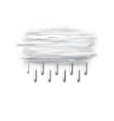
Wettervorhersage Stadt Nortorf

DEULängengrad : 9°18’,39 E Breitengrad : 53°55’,698 N Höhe : -3m
Mo
08
-
- -
Di
09
-
- -
Mi
10
-
- -
Do
11
-
- -
Fr
12
-
- -
Sa
13
-
- -
So
14
-
- -
Mo
15
-
- -
Di
16
-
- -
Mi
17
-
- -
Do
18
-
- -
Fr
19
-
- -
Sa
20
-
- -
So
21
-
- -
Mo
22
-
- -

NEWSLETTER

(in Ortszeit festgelegt)
Zuverlässigkeit 90%
Montag 8 dezember

Wettervorhersage

Regen (mm) (mm)
Wolkendecke(%.)
Niederschlagsmenge(mm)
Niederschlagsart
Niederschlagsgefahr(%.)
Feuchtigkeit(%.)
Sichtweite(km)
UV

Temperatur

Lufttemperatur
Gefühlt temp.
Lufttemperatur
Gefühlte Temp.
Null-Grad-Isotherme (m)
Regen-/Schneegrenze (m)

Wind

Durchschnittliche Winde
Böen
10m vom Boden entfernt:
Windrichtung
Windgeschwindigkeit
Böen

Gesundheit

Druck (hPa) (hPa)
Druck (hPa)
Pollen (Birke) (pollen/m3)
Pollen (Olivenbaum) (pollen/m3)
Pollen (Gräser) (pollen/m3)
Pollen (Ambrosia) (pollen/m3)
Verschmutzung (ATMO)
Verschmutzung (AQI)
Verschmutzung (CAQI)
9
6
3
0
15
10
5
0
55
50
45
40
35
40
30
20
10
0
70
60
50
40
30
20
10
20
15
10
5
50
40
30
20
10
1020
1010
1000
  • Di. 9
  • 02h
  • 03h
  • 04h
  • 05h
  • 06h
  • 07h
  • 08h
  • 09h
  • 10h
  • 11h
  • 12h
  • 13h
  • 14h
  • 15h
  • 16h
  • 17h
  • 18h
  • 19h
  • 20h
  • 21h
  • 22h
  • 23h
  • 00h
  • 01h
  • Di. 9
  • 02h
  • 03h
  • 04h
  • 05h
  • 06h
  • 07h
  • 08h
  • 09h
  • 10h
  • 11h
  • 12h
  • 13h
  • 14h
  • 15h
  • 16h
  • 17h
  • 18h
  • 19h
  • 20h
  • 21h
  • 22h
  • 23h
  • 00h
  • 01h
  • 100
  • 100
  • 100
  • 75
  • 20
  • 30
  • 40
  • 45
  • 90
  • 100
  • 95
  • 95
  • 100
  • 100
  • 100
  • 100
  • 100
  • 100
  • 100
  • 100
  • 100
  • 100
  • 100
  • 100
  • 2.1
  • 0.4
  • 0
  • 0
  • 0
  • 0
  • 0
  • 0
  • 0
  • 0
  • 0
  • 0
  • 0.1
  • 0
  • 0
  • 0
  • 0
  • 0
  • 0.3
  • 0.2
  • 0.5
  • 0
  • 0
  • 0
  • -
  • -
  • -
  • -
  • -
  • -
  • -
  • -
  • -
  • -
  • -
  • -
  • -
  • 90
  • 60
  • 25
  • 0
  • 0
  • 0
  • 0
  • 0
  • 0
  • 0
  • 0
  • 0
  • 65
  • 0
  • 0
  • 25
  • 35
  • 45
  • 55
  • 65
  • 55
  • 35
  • 0
  • 0
  • 95
  • 94
  • 86
  • 85
  • 85
  • 88
  • 90
  • 91
  • 90
  • 89
  • 87
  • 85
  • 86
  • 86
  • 87
  • 89
  • 92
  • 93
  • 93
  • 95
  • 94
  • 94
  • 94
  • 94
  • >20
  • >20
  • >20
  • >20
  • >20
  • >20
  • >20
  • >20
  • >20
  • >20
  • >20
  • >20
  • >20
  • >20
  • >20
  • >20
  • >20
  • >20
  • >20
  • >20
  • >20
  • >20
  • 15
  • 15
  • 0
  • 0
  • 0
  • 0
  • 0
  • 0
  • 0
  • 0
  • 0
  • 0
  • 0
  • 0
  • 0
  • 0
  • 0
  • 0
  • 0
  • 0
  • 0
  • 0
  • 0
  • 0
  • 0
  • 0
  • 9 48
  • 10 51
  • 11 51
  • 10 50
  • 9 49
  • 9 47
  • 8 47
  • 8 47
  • 9 47
  • 9 49
  • 10 50
  • 10 51
  • 11 51
  • 11 51
  • 11 51
  • 11 52
  • 11 51
  • 11 51
  • 11 51
  • 11 51
  • 11 51
  • 10 51
  • 10 50
  • 10 50
  • 4 39
  • 5 41
  • 4 39
  • 4 38
  • 4 38
  • 4 39
  • 3 38
  • 3 38
  • 4 39
  • 4 40
  • 5 41
  • 6 43
  • 6 43
  • 7 44
  • 7 44
  • 7 44
  • 6 44
  • 7 44
  • 7 45
  • 7 44
  • 7 44
  • 7 44
  • 7 44
  • 7 44
  • 2600
  • 2350
  • 2300
  • 2250
  • 2150
  • 2150
  • 2050
  • 2050
  • 2050
  • 2100
  • 2000
  • 1950
  • 1950
  • 2000
  • 1950
  • 1950
  • 1900
  • 1950
  • 1950
  • 1900
  • 1900
  • 1950
  • 2000
  • 2000
  • 2250
  • 2050
  • 2000
  • 1950
  • 1850
  • 1850
  • 1750
  • 1750
  • 1750
  • 1800
  • 1700
  • 1650
  • 1650
  • 1700
  • 1650
  • 1650
  • 1600
  • 1650
  • 1650
  • 1600
  • 1600
  • 1650
  • 1700
  • 1700
  • 185° S S
  • 230° SW SW
  • 255° W WSW
  • 250° W WSW
  • 245° SW WSW
  • 235° SW SW
  • 230° SW SW
  • 220° SW SW
  • 220° SW SW
  • 225° SW SW
  • 225° SW SW
  • 220° SW SW
  • 215° SW SW
  • 215° SW SSW
  • 210° SW SSW
  • 215° SW SW
  • 220° SW SW
  • 225° SW SW
  • 225° SW SW
  • 220° SW SW
  • 230° SW SW
  • 245° SW WSW
  • 225° SW SW
  • 230° SW SW
  • 15 28 8 17
  • 16 29 8 18
  • 21 39 11 24
  • 20 37 10 23
  • 17 31 9 19
  • 14 26 7 16
  • 15 27 8 17
  • 14 26 7 16
  • 15 27 8 17
  • 17 31 9 19
  • 17 31 9 19
  • 15 28 8 17
  • 15 28 8 17
  • 13 24 7 15
  • 12 23 6 14
  • 13 24 7 15
  • 12 23 6 14
  • 12 22 6 14
  • 10 19 5 12
  • 11 20 6 12
  • 12 22 6 14
  • 10 19 5 12
  • 9 17 5 11
  • 9 17 5 11
  • 24 45 13 28
  • 25 47 13 29
  • 35 64 18 40
  • 35 65 18 40
  • 31 58 16 36
  • 26 48 13 30
  • 23 43 12 27
  • 23 43 12 27
  • 23 43 12 27
  • 28 51 14 32
  • 28 52 14 32
  • 27 50 14 31
  • 25 46 13 29
  • 24 44 12 27
  • 21 39 11 24
  • 21 39 11 24
  • 22 40 11 25
  • 21 38 11 24
  • 19 36 10 22
  • 18 34 9 21
  • 19 36 10 22
  • 21 38 11 24
  • 17 32 9 20
  • 16 29 8 18
  • 1001
  • 1002
  • 1003
  • 1004
  • 1005
  • 1006
  • 1007
  • 1008
  • 1009
  • 1009
  • 1009
  • 1009
  • 1009
  • 1009
  • 1010
  • 1010
  • 1010
  • 1010
  • 1010
  • 1011
  • 1011
  • 1011
  • 1012
  • 1012
  • l-l-pollen_tree_birch.unavailable
  • l-l-pollen_tree_olive.unavailable
  • l-l-pollen_grass.unavailable
  • l-l-pollen_herb_ragweed.unavailable
  • 1
  • 1
  • 1
  • 2
  • 2
  • 2
  • 2
  • 2
  • 2
  • 2
  • 2
  • 2
  • 2
  • 2
  • 2
  • 2
  • 2
  • 2
  • 2
  • 1
  • 1
  • 1
  • 1
  • 2
  • 37
  • 41
  • 41
  • 52
  • 54
  • 56
  • 57
  • 52
  • 48
  • 47
  • 49
  • 50
  • 53
  • 48
  • 47
  • 48
  • 48
  • 48
  • 46
  • 45
  • 43
  • 43
  • 44
  • 46
  • 17
  • 19
  • 19
  • 24
  • 25
  • 25
  • 26
  • 24
  • 22
  • 21
  • 22
  • 22
  • 24
  • 22
  • 21
  • 22
  • 22
  • 22
  • 21
  • 20
  • 20
  • 20
  • 20
  • 21
Prognosen in Ortszeit erstellt
Letztes Update vor 1h | Nächstes Update in 2h
Legende

Expertenmeinung

Today in Nortorf, warning: strong gusts.
Sun but cloud increasing in the morning, very cloudy skies becoming totally covered in the afternoon. No precipitation in the morning, drizzle fading over time in the afternoon.

We are 90% sure of the situation, because the strength of the precipitation is difficult to assess for this type of disturbance.

Temperatures will vary between 8 and 11°C.

Tonight, overcast and misty, reduced visibility.
Light showers progressively becoming less frequent. Moderate winds.

Mo
08
-
- -
Di
09
-
- -
Mi
10
-
- -
Do
11
-
- -
Fr
12
-
- -
Sa
13
-
- -
So
14
-
- -
Mo
15
-
- -
Di
16
-
- -
Mi
17
-
- -
Do
18
-
- -
Fr
19
-
- -
Sa
20
-
- -
So
21
-
- -
Mo
22
-
- -
Deutsch