Wettervorhersage Stadt Petlapixca

MEXLng : -98°46’,872 W Lat : 21°10’,278 N Höhe : 302m
Fr
06
-
- -
Sa
07
-
- -
So
08
-
- -
Mo
09
-
- -
Di
10
-
- -
Mi
11
-
- -
Do
12
-
- -
Fr
13
-
- -
Sa
14
-
- -
So
15
-
- -
Mo
16
-
- -
Di
17
-
- -
Mi
18
-
- -
Do
19
-
- -
Fr
20
-
- -

NEWSLETTER

Zuverlässigkeit 90%
Freitag 6 november Freitag 6 nov
METEO CONSULT Run : 6/11 06Z Auflösung : 19km Update vor 5h Update in 52min

Wettervorhersage

Regen (mm) (mm)
Wolken:
Wolkendecke (%.)
Niederschlag:
Niederschlagsmenge Niederschlagsmenge (mm)
Niederschlagsart Niederschlagsart
Risiken:
Niederschlagsgefahr Niederschlagsgefahr (%.)
Stürmgefahr. (%.)
Helligkeit:
Feuchtigkeit (%.)
Sichtweite (km)
UV

Temperatur

Lufttemperatur Lufttemperatur
Gefühlt temp.
Lufttemperatur
Gefühlte Temp.
Null-Grad-Isotherme (m)
Regen-/Schneegrenze Regen-/Schneegrenze (m)

Wind

Durchschnittliche Winde Durchschnittliche Winde
Böen
10m vom Boden entfernt:
Windrichtung
Windgeschwindigkeit
Böen
Unter Stürmen

Gesundheit

Druck (hPa) (hPa)
Druck (hPa)
Pollen  (pollen/m3) :
Pollen (Birke)
Pollen (Olivenbaum)
Pollen (Gräser)
Pollen (Ambrosia)
Luftqualitätsindex:
Verschmutzung (ATMO)
Verschmutzung (AQI)
Verschmutzung (CAQI)
3
0
40
35
30
25
20
15
110
100
90
80
70
60
10
5
0
15
10
5
0
5
0
10
5
0
1020
1015
1010
  • Sa. 7
  • 10h
  • 11h
  • 12h
  • 13h
  • 14h
  • 15h
  • 16h
  • 17h
  • 18h
  • 19h
  • 20h
  • 21h
  • 22h
  • 23h
  • 00h
  • 01h
  • 02h
  • 03h
  • 04h
  • 05h
  • 06h
  • 07h
  • 08h
  • 09h
Run : 6/11 06Z Auflösung : 19km Update vor 5h Update in 52min
  • Sa. 7
  • 10h
  • 11h
  • 12h
  • 13h
  • 14h
  • 15h
  • 16h
  • 17h
  • 18h
  • 19h
  • 20h
  • 21h
  • 22h
  • 23h
  • 00h
  • 01h
  • 02h
  • 03h
  • 04h
  • 05h
  • 06h
  • 07h
  • 08h
  • 09h
  • 65
  • 55
  • 50
  • 55
  • 55
  • 70
  • 85
  • 85
  • 90
  • 90
  • 90
  • 90
  • 90
  • 90
  • 90
  • 90
  • 90
  • 90
  • 90
  • 90
  • 95
  • 95
  • 95
  • 100
  • 0
  • 0
  • 0.1
  • 0.1
  • 0.1
  • 0.5
  • 0.6
  • 0.6
  • 1.9
  • 1.5
  • 1.1
  • 0.7
  • 0.7
  • 0.6
  • 0.4
  • 0.2
  • 0.1
  • 0
  • 0
  • 0
  • 0
  • 0
  • 0
  • 0
  • 45
  • 45
  • 50
  • 55
  • 60
  • 65
  • 75
  • 80
  • 85
  • 80
  • 80
  • 80
  • 80
  • 80
  • 75
  • 60
  • 50
  • 40
  • 40
  • 45
  • 45
  • 40
  • 40
  • 40
  • 40
  • 40
  • 50
  • 50
  • 60
  • 60
  • 70
  • 70
  • 80
  • 80
  • 70
  • 60
  • 20
  • 0
  • 0
  • 0
  • 0
  • 0
  • 0
  • 0
  • 0
  • 0
  • 0
  • 0
  • 81
  • 77
  • 74
  • 71
  • 69
  • 68
  • 78
  • 86
  • 91
  • 94
  • 95
  • 96
  • 96
  • 97
  • 97
  • 97
  • 97
  • 97
  • 97
  • 97
  • 98
  • 98
  • 97
  • 95
  • 10
  • >20
  • >20
  • >20
  • >20
  • >20
  • 15
  • 5
  • 3
  • 1
  • 0.5
  • 0.4
  • 0.4
  • 0.2
  • 0.2
  • 0.2
  • 0.2
  • 0.2
  • 0.2
  • 0.2
  • <0.1
  • 0.2
  • 0.2
  • 0.5
  • 3
  • 5
  • 7
  • 6
  • 4
  • 2
  • 1
  • 0
  • 0
  • 0
  • 0
  • 0
  • 0
  • 0
  • 0
  • 0
  • 0
  • 0
  • 0
  • 0
  • 0
  • 0
  • 0
  • 1
  • 26 79
  • 27 80
  • 28 82
  • 28 82
  • 27 81
  • 27 80
  • 26 78
  • 25 77
  • 23 74
  • 23 73
  • 22 72
  • 22 71
  • 22 71
  • 21 71
  • 21 70
  • 21 70
  • 21 69
  • 21 69
  • 21 69
  • 20 69
  • 20 68
  • 20 69
  • 21 70
  • 22 71
  • 32 89
  • 36 97
  • 38 100
  • 37 99
  • 37 98
  • 35 95
  • 33 91
  • 30 87
  • 27 80
  • 26 79
  • 26 79
  • 26 78
  • 25 77
  • 25 77
  • 25 77
  • 25 76
  • 25 76
  • 24 76
  • 24 76
  • 24 75
  • 24 75
  • 24 75
  • 25 76
  • 27 81
  • 4750
  • 4750
  • 4750
  • 4750
  • 4750
  • 4750
  • 4750
  • 4750
  • 4750
  • 4750
  • 4800
  • 4800
  • 4800
  • 4750
  • 4700
  • 4700
  • 4700
  • 4700
  • 4700
  • 4700
  • 4700
  • 4750
  • 4800
  • 4800
  • 4450
  • 4450
  • 4450
  • 4450
  • 4450
  • 4450
  • 4450
  • 4450
  • 4450
  • 4450
  • 4500
  • 4500
  • 4500
  • 4450
  • 4400
  • 4400
  • 4400
  • 4400
  • 4400
  • 4400
  • 4400
  • 4450
  • 4500
  • 4500
  • 20° N NNE
  • 30° NE NNE
  • 30° NE NNE
  • 25° NE NNE
  • 30° NE NNE
  • 35° NE NE
  • 40° NE NE
  • 30° NE NNE
  • 0° N N
  • 330° NW NNW
  • 300° NW WNW
  • 270° W W
  • 260° W W
  • 255° W WSW
  • 260° W W
  • 255° W WSW
  • 255° W WSW
  • 250° W WSW
  • 245° SW WSW
  • 270° W W
  • 280° W W
  • 285° W WNW
  • 320° NW NW
  • 350° N NNW
  • 2 4 1 2
  • 3 5 1 3
  • 3 6 2 4
  • 4 7 2 4
  • 3 6 2 4
  • 3 5 1 3
  • 3 5 1 3
  • 3 5 1 3
  • 2 4 1 2
  • 1 2 1 1
  • 1 2 1 1
  • 1 2 1 1
  • 1 2 1 1
  • 1 2 1 1
  • 1 2 1 1
  • 1 2 1 1
  • 1 1 0 1
  • 1 1 0 1
  • 1 1 0 1
  • 1 1 0 1
  • 1 2 1 1
  • 1 2 1 1
  • 1 1 0 1
  • 1 2 1 1
  • 5 9 3 6
  • 6 11 3 7
  • 7 13 4 8
  • 8 14 4 9
  • 8 14 4 9
  • 7 13 4 8
  • 7 13 4 8
  • 6 11 3 7
  • 5 10 3 6
  • 5 9 3 6
  • 4 7 2 4
  • 3 6 2 4
  • 3 6 2 4
  • 3 5 1 3
  • 2 4 1 2
  • 2 3 1 2
  • 2 3 1 2
  • 2 3 1 2
  • 2 3 1 2
  • 2 3 1 2
  • 2 3 1 2
  • 2 3 1 2
  • 2 4 1 2
  • 3 5 1 3
  • >40 >75 >21 >45
  • >40 >75 >21 >45
  • >40 >75 >21 >45
  • >40 >75 >21 >45
  • >40 >75 >22 >45
  • >40 >75 >22 >45
  • >40 >75 >22 >45
  • >40 >75 >22 >45
  • >40 >75 >22 >45
  • >40 >75 >21 >45
  • >35 >70 >20 >45
  • >35 >65 >19 >40
  • - - - -
  • - - - -
  • - - - -
  • - - - -
  • - - - -
  • - - - -
  • - - - -
  • - - - -
  • - - - -
  • - - - -
  • - - - -
  • - - - -
  • 1015
  • 1015
  • 1014
  • 1013
  • 1012
  • 1012
  • 1012
  • 1013
  • 1014
  • 1015
  • 1015
  • 1016
  • 1016
  • 1016
  • 1016
  • 1015
  • 1015
  • 1015
  • 1015
  • 1015
  • 1015
  • 1016
  • 1016
  • 1017
  • Daten verfügbar vom 1. März bis 31. Juli
  • Daten verfügbar vom 1. Januar bis 30. Jun
  • Daten verfügbar vom 1. März bis 31. August
  • Daten verfügbar vom 1. Juni bis 31. Oktober
  • 1
  • 2
  • 2
  • 2
  • 2
  • 2
  • 2
  • 2
  • 1
  • 1
  • 1
  • 1
  • 1
  • 1
  • 1
  • 1
  • 1
  • 1
  • 1
  • 1
  • 1
  • 1
  • 1
  • 1
  • 43
  • 50
  • 57
  • 59
  • 60
  • 61
  • 56
  • 50
  • 44
  • 43
  • 42
  • 40
  • 39
  • 37
  • 35
  • 36
  • 36
  • 37
  • 34
  • 31
  • 30
  • 32
  • 36
  • 40
  • 20
  • 23
  • 26
  • 27
  • 27
  • 28
  • 25
  • 22
  • 20
  • 20
  • 19
  • 18
  • 17
  • 17
  • 16
  • 16
  • 16
  • 17
  • 15
  • 14
  • 13
  • 15
  • 16
  • 18
Prognosen in Ortszeit erstellt
Legende   Glossar

Expertenmeinung

Today in Petlapixca, the unsettled weather will become more unpredictable as showers set in.
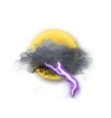
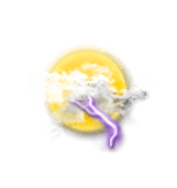
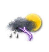
Very cloudy with risk of thunderstorms in the morning, skies clouding over with storms forming in the afternoon. Risk of showers in the morning, showers in the afternoon. Light winds.

The reliability of the situation is very good.

Temperatures will vary between 22 and 28°C, it will be warm in the afternoon.

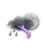
Tonight, warning: storms: considerable electrical activity.
Heavy showers. Light winds.

Mehr erfahren

Fr
06
-
- -
Sa
07
-
- -
So
08
-
- -
Mo
09
-
- -
Di
10
-
- -
Mi
11
-
- -
Do
12
-
- -
Fr
13
-
- -
Sa
14
-
- -
So
15
-
- -
Mo
16
-
- -
Di
17
-
- -
Mi
18
-
- -
Do
19
-
- -
Fr
20
-
- -
Deutsch