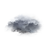
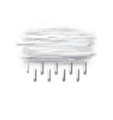
Wettervorhersage Stadt Rotenhahn

DEULängengrad : 10°2’,124 E Breitengrad : 54°14’,562 N Höhe : 21m
Do
23
-
- -
Fr
24
-
- -
Sa
25
-
- -
So
26
-
- -
Mo
27
-
- -
Di
28
-
- -
Mi
29
-
- -
Do
30
-
- -
Fr
31
-
- -
Sa
01
-
- -
So
02
-
- -
Mo
03
-
- -
Di
04
-
- -
Mi
05
-
- -
Do
06
-
- -

NEWSLETTER

(in Ortszeit festgelegt)
Zuverlässigkeit 85%
Donnerstag 23 oktober

Wettervorhersage

Regen (mm) (mm)
Wolkendecke(%.)
Niederschlagsmenge(mm)
Niederschlagsart
Niederschlagsgefahr(%.)
Feuchtigkeit(%.)
Sichtweite(km)
UV

Temperatur

Lufttemperatur
Gefühlt temp.
Lufttemperatur
Gefühlte Temp.
Null-Grad-Isotherme (m)
Regen-/Schneegrenze (m)

Wind

Durchschnittliche Winde
Böen
10m vom Boden entfernt:
Windrichtung
Windgeschwindigkeit
Böen

Gesundheit

Druck (hPa) (hPa)
Druck (hPa)
Pollen (Birke) (pollen/m3)
Pollen (Olivenbaum) (pollen/m3)
Pollen (Gräser) (pollen/m3)
Pollen (Ambrosia) (pollen/m3)
Verschmutzung (ATMO)
Verschmutzung (AQI)
Verschmutzung (CAQI)
3
0
15
10
5
0
60
55
50
45
40
30
20
10
0
50
40
30
20
10
0
15
10
5
0
30
20
10
0
1020
1010
1000
990
980
970
  • Fr. 24
  • 01h
  • 02h
  • 03h
  • 04h
  • 05h
  • 06h
  • 07h
  • 08h
  • 09h
  • 10h
  • 11h
  • 12h
  • 13h
  • 14h
  • 15h
  • 16h
  • 17h
  • 18h
  • 19h
  • 20h
  • 21h
  • 22h
  • 23h
  • 00h
  • Fr. 24
  • 01h
  • 02h
  • 03h
  • 04h
  • 05h
  • 06h
  • 07h
  • 08h
  • 09h
  • 10h
  • 11h
  • 12h
  • 13h
  • 14h
  • 15h
  • 16h
  • 17h
  • 18h
  • 19h
  • 20h
  • 21h
  • 22h
  • 23h
  • 00h
  • 85
  • 40
  • 90
  • 100
  • 100
  • 100
  • 100
  • 95
  • 100
  • 100
  • 100
  • 100
  • 100
  • 100
  • 100
  • 100
  • 100
  • 100
  • 85
  • 70
  • 85
  • 90
  • 100
  • 100
  • 0
  • 0
  • 0
  • 0
  • 0
  • 0
  • 0
  • 0
  • 0
  • 0.9
  • 0.9
  • 1.6
  • 1.1
  • 0.7
  • 0.6
  • 0.2
  • 0.3
  • 0
  • 0
  • 0
  • 0
  • 0
  • 0
  • 0
  • -
  • -
  • -
  • -
  • -
  • -
  • -
  • -
  • -
  • -
  • 0
  • 0
  • 0
  • 0
  • 0
  • 0
  • 0
  • 20
  • 40
  • 65
  • 85
  • 75
  • 65
  • 55
  • 75
  • 80
  • 55
  • 35
  • 0
  • 0
  • 0
  • 25
  • 40
  • 35
  • 97
  • 98
  • 99
  • 99
  • 99
  • 98
  • 97
  • 94
  • 94
  • 94
  • 94
  • 94
  • 94
  • 92
  • 93
  • 93
  • 90
  • 93
  • 91
  • 91
  • 90
  • 88
  • 88
  • 89
  • 1
  • 0.5
  • 0.2
  • <0.1
  • 0.2
  • 1
  • 5
  • >20
  • >20
  • >20
  • >20
  • >20
  • >20
  • >20
  • >20
  • >20
  • >20
  • 10
  • 5
  • 10
  • >20
  • >20
  • >20
  • >20
  • 0
  • 0
  • 0
  • 0
  • 0
  • 0
  • 0
  • 0
  • 0
  • 0
  • 0
  • 0
  • 0
  • 0
  • 0
  • 0
  • 0
  • 0
  • 0
  • 0
  • 0
  • 0
  • 0
  • 0
  • 8 46
  • 7 45
  • 7 45
  • 7 45
  • 8 46
  • 8 47
  • 9 48
  • 10 50
  • 11 51
  • 11 52
  • 11 52
  • 12 53
  • 12 54
  • 13 55
  • 13 56
  • 13 56
  • 13 55
  • 12 54
  • 12 53
  • 11 52
  • 11 52
  • 11 52
  • 11 51
  • 10 50
  • 6 43
  • 6 43
  • 5 42
  • 5 42
  • 5 41
  • 6 42
  • 6 42
  • 6 43
  • 6 43
  • 6 44
  • 7 44
  • 7 45
  • 8 46
  • 9 48
  • 10 49
  • 10 50
  • 10 50
  • 10 49
  • 9 49
  • 9 47
  • 8 47
  • 8 46
  • 7 45
  • 7 45
  • 2100
  • 2100
  • 2100
  • 2150
  • 2300
  • 2450
  • 2500
  • 2400
  • 2500
  • 2600
  • 2650
  • 2750
  • 2800
  • 2700
  • 2600
  • 2550
  • 2300
  • 2100
  • 1900
  • 1700
  • 1650
  • 1650
  • 1650
  • 1750
  • 1800
  • 1800
  • 1800
  • 1850
  • 2000
  • 2150
  • 2200
  • 2100
  • 2200
  • 2300
  • 2350
  • 2450
  • 2500
  • 2400
  • 2300
  • 2250
  • 2000
  • 1800
  • 1600
  • 1400
  • 1350
  • 1350
  • 1350
  • 1450
  • 150° SE SSE
  • 130° SE SE
  • 115° SE ESE
  • 115° SE ESE
  • 110° E ESE
  • 100° E ESE
  • 100° E E
  • 100° E E
  • 100° E E
  • 105° E ESE
  • 110° E ESE
  • 120° SE ESE
  • 130° SE SE
  • 135° SE SE
  • 140° SE SE
  • 155° SE SSE
  • 205° SW SSW
  • 185° S S
  • 160° S SSE
  • 150° SE SSE
  • 140° SE SE
  • 145° SE SE
  • 140° SE SE
  • 145° SE SE
  • 4 8 2 5
  • 4 7 2 4
  • 4 7 2 4
  • 5 9 3 6
  • 6 12 3 7
  • 8 14 4 9
  • 10 18 5 11
  • 11 21 6 13
  • 12 22 6 14
  • 13 24 7 15
  • 13 24 7 15
  • 13 24 7 15
  • 12 23 6 14
  • 11 21 6 13
  • 11 20 6 12
  • 9 17 5 11
  • 9 16 4 10
  • 8 14 4 9
  • 6 12 3 7
  • 7 13 4 8
  • 8 14 4 9
  • 9 17 5 11
  • 10 18 5 11
  • 9 16 4 10
  • 6 12 3 7
  • 6 12 3 7
  • 6 11 3 7
  • 9 16 4 10
  • 11 21 6 13
  • 13 25 7 16
  • 17 31 9 19
  • 19 36 10 22
  • 22 40 11 25
  • 23 43 12 27
  • 25 46 13 29
  • 25 47 13 29
  • 24 45 13 28
  • 23 43 12 27
  • 23 42 12 26
  • 19 36 10 22
  • 20 37 10 23
  • 16 29 8 18
  • 14 26 7 16
  • 12 23 6 14
  • 14 26 7 16
  • 18 33 9 21
  • 17 32 9 20
  • 17 32 9 20
  • 997
  • 996
  • 995
  • 994
  • 992
  • 991
  • 989
  • 987
  • 986
  • 984
  • 983
  • 982
  • 982
  • 981
  • 981
  • 980
  • 981
  • 981
  • 981
  • 981
  • 981
  • 980
  • 980
  • 980
  • l-l-pollen_tree_birch.unavailable
  • l-l-pollen_tree_olive.unavailable
  • l-l-pollen_grass.unavailable
  • 0
  • 0
  • 0
  • 0
  • 0
  • 0
  • 0
  • 0
  • 0
  • 0
  • 0
  • 0
  • 0
  • 0
  • 0
  • 0
  • 0
  • 0
  • 0
  • 0
  • 0
  • 0
  • 0
  • 0
  • 2
  • 2
  • 2
  • 2
  • 2
  • 2
  • 2
  • 2
  • 2
  • 1
  • 1
  • 1
  • 1
  • 1
  • 1
  • 1
  • 1
  • 1
  • 1
  • 1
  • 1
  • 1
  • 1
  • 1
  • 46
  • 48
  • 50
  • 52
  • 52
  • 50
  • 50
  • 50
  • 42
  • 38
  • 37
  • 35
  • 33
  • 32
  • 34
  • 32
  • 34
  • 30
  • 30
  • 27
  • 29
  • 32
  • 33
  • 32
  • 25
  • 26
  • 28
  • 30
  • 30
  • 28
  • 28
  • 28
  • 21
  • 17
  • 17
  • 16
  • 15
  • 15
  • 15
  • 15
  • 15
  • 13
  • 13
  • 12
  • 13
  • 15
  • 15
  • 15
Prognosen in Ortszeit erstellt
Letztes Update vor 37min | Nächstes Update in 3h
Legende

Expertenmeinung

Today in Rotenhahn, the unsettled weather will become more unpredictable as showers set in.
Very cloudy skies to overcast. Light rain in late morning, showers in the afternoon. Moderate winds.

We are 85% sure of the situation, because it is possible that the change in the rain system may not be as clear as forecast.

Temperatures will vary between 8 and 13°C.

Tonight, very cloudy skies to overcast.
Possibility of showers Moderate winds.

Do
23
-
- -
Fr
24
-
- -
Sa
25
-
- -
So
26
-
- -
Mo
27
-
- -
Di
28
-
- -
Mi
29
-
- -
Do
30
-
- -
Fr
31
-
- -
Sa
01
-
- -
So
02
-
- -
Mo
03
-
- -
Di
04
-
- -
Mi
05
-
- -
Do
06
-
- -
Deutsch
NEU : der Wetter-Picker auf der interaktiven Karte